Uploads by Servant
From CreationWiki
Jump to navigationJump to search
This special page shows all uploaded files.
| Date | Name | Thumbnail | Size | Description | Versions |
|---|---|---|---|---|---|
| 19:25, 29 July 2020 | CPT start.PNG (file) |  |
258 KB | Starting position of the instability in the computer model of Catastrophic Plate Tectonics. | 1 |
| 20:02, 28 July 2020 | CPT after 25 days.PNG (file) |  |
552 KB | Computer animation of Catastrophic Plate Tectonics twenty-five days forward. | 1 |
| 04:19, 17 July 2020 | Convection cells.PNG (file) |  |
553 KB | Cartoon of Plate Tectonics convection cells | 2 |
| 03:28, 17 July 2020 | Runaway subduction Baumgardner.PNG (file) |  |
246 KB | Frame from computer simulation of runaway subduction. | 1 |
| 03:13, 17 July 2020 | Slab dip angles.PNG (file) |  |
239 KB | Chart of all subduction zone dip angles on Earth. Annotations modified. | 1 |
| 00:29, 3 December 2019 | Age of the Universe book Gorman Gray.PNG (file) |  |
272 KB | Cover picture of the book "Age of the Universe: What are the biblical limits?" by Gorman Gray | 1 |
| 18:36, 16 November 2019 | Bernard Northrup.jpg (file) |  |
16 KB | Picture of the late Dr. Bernard Northrup, biblical scholar and teacher. | 1 |
| 17:03, 10 October 2019 | Shroud full length.PNG (file) |  |
358 KB | Entire Shroud of Turin | 1 |
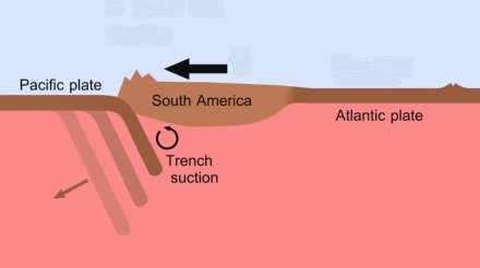
| 04:19, 15 July 2019 | South Am motion.jpg (file) |  |
15 KB | Illustration of South America being pulled by trench suction. Based on Plate Tectonics theory. | 1 |
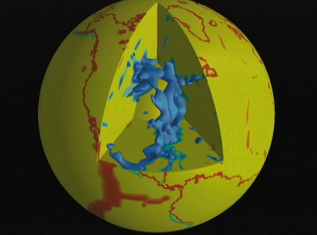
| 04:10, 15 July 2019 | Below North America.jpg (file) |  |
55 KB | Seismic tomography illustration of remnants beneath North America | 1 |
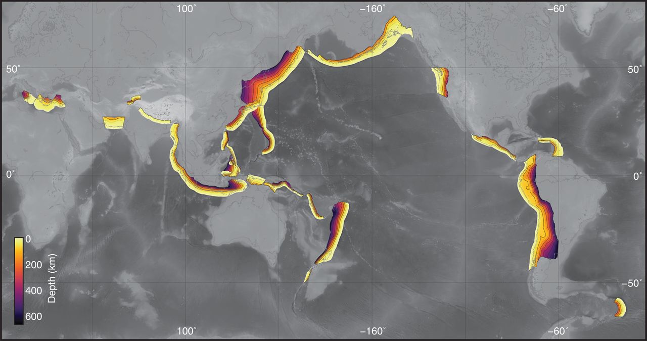
| 03:21, 15 July 2019 | Subduction zones depth.jpg (file) |  |
102 KB | Global map of subduction zones and slab depth from the Slab2 database. Collection of 3D Geometries - EQ | 1 |
| 03:44, 8 July 2019 | ETOPO1 Pacific poster snip.JPG (file) |  |
140 KB | A selected segment of the ETOPO1 global relief map made available by NOAA's National Geophysical Data Center on their website. | 1 |
| 02:08, 8 July 2019 | 3Australasian.jpg (file) |  |
18 KB | The light brown area indicates the approximate extent of the Australasian tektite strewnfield. | 1 |
| 03:13, 2 July 2019 | Longrunout.jpg (file) | 10 KB | Illustration of a long runout landslide traveling horizontally 30 times farther than it fell. | 1 | |
| 03:05, 2 July 2019 | OutsideMounts.jpg (file) |  |
72 KB | Global map showing movement away from the central point identified in the Shock Dynamics geology theory. | 1 |