File:World ocean map.gif
World_ocean_map.gif (500 × 500 pixels, file size: 68 KB, MIME type: image/gif, looped, 4 frames, 10 s)
Summary
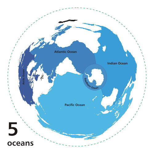
Map of the worlds ocean from various perspective.
Azimuthal distance projection map is based on world map from this online Java tool by Henry Bottomley and altered using CorelDraw/PhotoPaint, et al. Map is centered on 85° W, 45° S, rotated 90° CCW (North Pole is to the left). Ocean boundaries per International Hydrographic Organisation.
blue: ocean black: other substantial bodies of water (viz. Caspian Sea, Great Lakes) white: land green dotted line: map periphery
Copyright status:
I, the copyright holder of this work, release this work into the public domain. This applies worldwide. In some countries this may not be legally possible; if so: I grant anyone the right to use this work for any purpose, without any conditions, unless such conditions are required by law.
Source:
File history
Click on a date/time to view the file as it appeared at that time.
| Date/Time | Thumbnail | Dimensions | User | Comment | |
|---|---|---|---|---|---|
| current | 17:47, 19 November 2010 | | 500 × 500 (68 KB) | Ashcraft (talk | contribs) | Map of the worlds ocean from various perspective. Azimuthal distance projection map is based on world map from this online Java tool by Henry Bottomley and altered using CorelDraw/PhotoPaint, et al. Map is centered on 85° W, 45° S, rotated 90° CCW (No |
You cannot overwrite this file.
File usage
There are no pages that use this file.