File:Sunflower map.png
Original file (1,600 × 960 pixels, file size: 466 KB, MIME type: image/png)
Summary
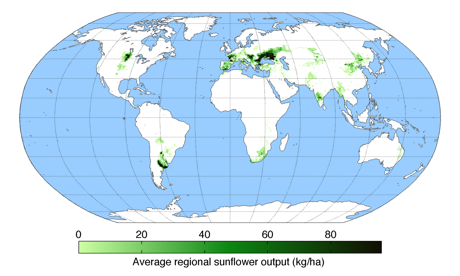
Worldwide sunflower output
Map of sunflower production (average percentage of land used for its production times average yield in each grid cell) across the world compiled by the University of Minnesota Institute on the Environment with data from: Monfreda, C., N. Ramankutty, and J.A. Foley. 2008. Farming the planet: 2. Geographic distribution of crop areas, yields, physiological types, and net primary production in the year 2000. Global Biogeochemical Cycles 22: GB1022
Copyright status:
none
Source:
https://en.wikipedia.org/wiki/Helianthus_annuus#/media/File:SunflowerYield.png
File history
Click on a date/time to view the file as it appeared at that time.
| Date/Time | Thumbnail | Dimensions | User | Comment | |
|---|---|---|---|---|---|
| current | 19:33, 13 May 2017 | | 1,600 × 960 (466 KB) | Edward (talk | contribs) | Worldwide sunflower output Map of sunflower production (average percentage of land used for its production times average yield in each grid cell) across the world compiled by the University of Minnesota Institute on the Environment with data from: Mon... |
You cannot overwrite this file.
File usage
There are no pages that use this file.