File:Hydrothermal vents map.png
Hydrothermal_vents_map.png (800 × 406 pixels, file size: 679 KB, MIME type: image/png)
Summary
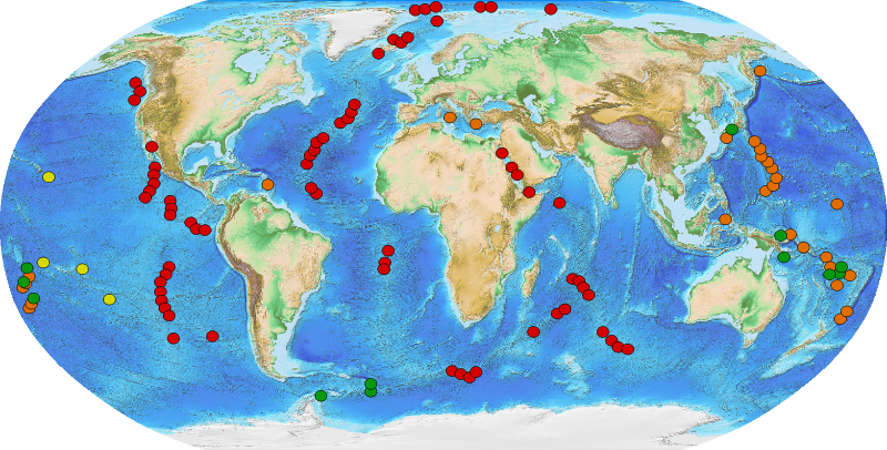
Description Français : Carte des monts hydrothermaux. Source des données : http://www.pmel.noaa.gov/vents/PlumeStudies/global-hydrothermal-vent-locations.html Date 14 April 2011 Source Data from NOAA's « Vents Program » : http://www.pmel.noaa.gov/vents/PlumeStudies/global-hydrothermal-vent-locations.html Amante, C. and B. W. Eakins, ETOPO1 1 Arc-Minute Global Relief Model: Procedures, Data Sources and Analysis, National Geophysical Data Center, NESDIS, NOAA, U.S. Department of Commerce, Boulder, CO, August 2008. Author Savant-fou/NOAA
Copyright status:
I, the copyright holder of this work, hereby publish it under the following licenses: GNU head Permission is granted to copy, distribute and/or modify this document under the terms of the GNU Free Documentation License, Version 1.2 or any later version published by the Free Software Foundation; with no Invariant Sections, no Front-Cover Texts, and no Back-Cover Texts. A copy of the license is included in the section entitled GNU Free Documentation License. w:en:Creative Commons attribution share alike This file is licensed under the Creative Commons Attribution-Share Alike 3.0 Unported, 2.5 Generic, 2.0 Generic and 1.0 Generic license. You are free: to share – to copy, distribute and transmit the work to remix – to adapt the work Under the following conditions: attribution – You must attribute the work in the manner specified by the author or licensor (but not in any way that suggests that they endorse you or your use of the work). share alike – If you alter, transform, or build upon this work, you may distribute the resulting work only under the same or similar license to this one.
Source:
https://commons.wikimedia.org/wiki/File:Hydrothermal_vents_map.svg
File history
Click on a date/time to view the file as it appeared at that time.
| Date/Time | Thumbnail | Dimensions | User | Comment | |
|---|---|---|---|---|---|
| current | 09:49, 26 November 2018 | | 800 × 406 (679 KB) | ChrisCanada (talk | contribs) | Description Français : Carte des monts hydrothermaux. Source des données : http://www.pmel.noaa.gov/vents/PlumeStudies/global-hydrothermal-vent-locations.html Date 14 April 2011 Source Data from NOAA's « Vents Program » : http://www.pmel.noaa.gov... |
You cannot overwrite this file.
File usage
There are no pages that use this file.