File:Subduction zones depth.jpg
From CreationWiki
Jump to navigationJump to search
Size of this preview: 800 × 422 pixels. Other resolution: 1,280 × 675 pixels.
Original file (1,280 × 675 pixels, file size: 102 KB, MIME type: image/jpeg)
Summary
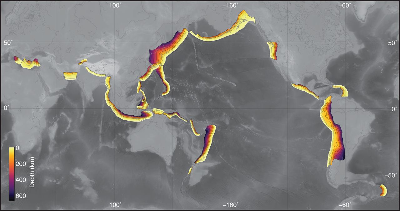
Global map of subduction zones and slab depth from the Slab2 database. Collection of 3D Geometries - EQ
Copyright status:
Public domain
Licensing
| This work is in the public domain in the United States because it is a work prepared by an officer or employee of the United States Government as part of that person’s official duties under the terms of Title 17, Chapter 1, Section 105 of the US Code. See Copyright. |

| |
| Note: This only applies to original works of the Federal Government and not to the work of any individual U.S. state, territory, commonwealth, county, municipality, or any other subdivision. This template also does not apply to postage stamp designs published by the United States Postal Service since 1978. (See 206.02(b) of Compendium II: Copyright Office Practices). It also does not apply to certain US coins; see The US Mint Terms of Use. | ||
| This file has been identified as being free of known restrictions under copyright law, including all related and neighboring rights. | ||
Source:
https://www.usgs.gov/media/images/collection-3d-geometries-eq
File history
Click on a date/time to view the file as it appeared at that time.
| Date/Time | Thumbnail | Dimensions | User | Comment | |
|---|---|---|---|---|---|
| current | 03:21, 15 July 2019 | | 1,280 × 675 (102 KB) | Servant (talk | contribs) | Global map of subduction zones and slab depth from the Slab2 database. Collection of 3D Geometries - EQ |
You cannot overwrite this file.
File usage
There are no pages that use this file.