File:Prelazak.jpg
From CreationWiki
Jump to navigationJump to search
No higher resolution available.
Prelazak.jpg (800 × 400 pixels, file size: 205 KB, MIME type: image/jpeg)
Summary
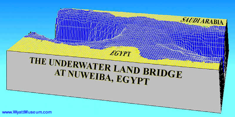
Official data from the US National Geophysical Data Center suggest that there is a distinct underwater bridge from coast to coast with a maximum depth of approximately 300 feet. In the figure we can see measured gradient across the Gulf of Aqaba
Copyright status
I, the creator of this work, hereby release it into the public domain. This applies worldwide. In case this is not legally possible, I grant any entity the right to use this work for any purpose, without any conditions, unless such conditions are required by law.
Source
File history
Click on a date/time to view the file as it appeared at that time.
| Date/Time | Thumbnail | Dimensions | User | Comment | |
|---|---|---|---|---|---|
| current | 18:56, 30 June 2007 | | 800 × 400 (205 KB) | Bokiva (talk | contribs) | Official data from the US National Geophysical Data Center suggest that there is a distinct underwater bridge from coast to coast with a maximum depth of approximately 300 feet. In the figure we can see measured gradient across the Gulf of Aqaba |
You cannot overwrite this file.
File usage
There are no pages that use this file.