File:Ogallala aquifer map.jpg
From CreationWiki
Jump to navigationJump to search

Size of this preview: 470 × 600 pixels. Other resolution: 529 × 675 pixels.
Original file (529 × 675 pixels, file size: 304 KB, MIME type: image/jpeg)
Summary
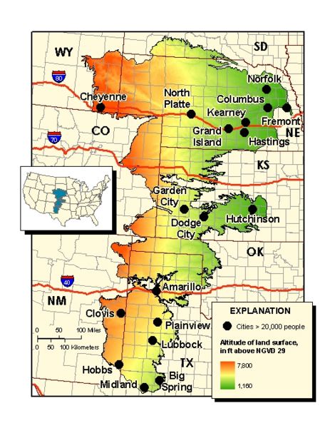
Location map showing the boundary of the High Plains (Ogallala) aquifer, major cities and roads, and altitude of land surface.
Copyright status
This image is public domain because it was first published by the U.S. Geological Survey.
Source
File history
Click on a date/time to view the file as it appeared at that time.
| Date/Time | Thumbnail | Dimensions | User | Comment | |
|---|---|---|---|---|---|
| current | 18:46, 21 February 2007 | | 529 × 675 (304 KB) | Ashcraft (talk | contribs) | Location map showing the boundary of the High Plains (Ogallala) aquifer, major cities and roads, and altitude of land surface. |
You cannot overwrite this file.
File usage
There are no pages that use this file.