File:800px-Indo-Pacific biogeographic region map-en.svg.png
From CreationWiki
Jump to navigationJump to search
No higher resolution available.
800px-Indo-Pacific_biogeographic_region_map-en.svg.png (800 × 492 pixels, file size: 157 KB, MIME type: image/png)
Summary
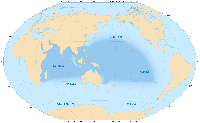
Map in English of the area covered by the Indo-Pacific biogeographic region. Scale : 1:5,000,000 Winkel Tripel projection, WGS84 datum, central meridian : 150°E. Date
May 2008(2008-05) Source
Own work
   * Coast lines : U.S. NGDC World Coast Line ;
   * Reference for the limits of the Indo-Pacific biogeographic region : Spalding, Mark D., Helen E. Fox, Gerald R. Allen, Nick Davidson et al. "Marine Ecoregions of the World: A Bioregionalization of Coastal and Shelf Areas". Bioscience Vol. 57 No. 7, July/August 2007, pp. 573-583, available through the World Wildlife Fund's site
Author
Eric Gaba
Copyright status:
http://en.wikipedia.org/wiki/en:Creative_Commons
Source:
http://commons.wikimedia.org/wiki/File:Indo-Pacific_biogeographic_region_map-en.svg
File history
Click on a date/time to view the file as it appeared at that time.
| Date/Time | Thumbnail | Dimensions | User | Comment | |
|---|---|---|---|---|---|
| current | 00:13, 10 December 2010 | | 800 × 492 (157 KB) | Emaloy (talk | contribs) | Map in English of the area covered by the Indo-Pacific biogeographic region. Scale : 1:5,000,000 Winkel Tripel projection, WGS84 datum, central meridian : 150°E. Date May 2008(2008-05) Source Own work * Coast lines : U.S. NGDC World Coast Line |
You cannot overwrite this file.
File usage
There are no pages that use this file.