File:Pacific Ring of Fire.png

Original file (1,024 × 760 pixels, file size: 664 KB, MIME type: image/png)
Summary
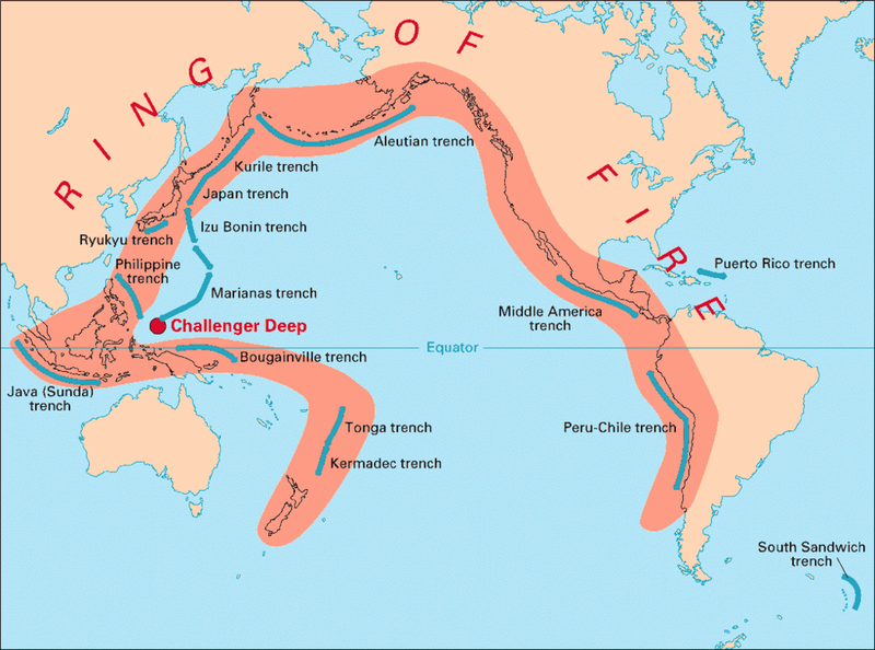
English: Volcanic arcs and oceanic trenches partly encircling the Pacific Basin form the so-called Pacific Ring of fire, a zone of frequent earthquakes and volcanic eruptions. The trenches are shown in blue-green. The volcanic island arcs, although not labelled, are parallel to, and always landward of, the trenches. For example, the island arc associated with the Aleutian Trench is represented by the long chain of volcanoes that make up the Aleutian Islands. Source: http://pubs.usgs.gov/publications/text/fire.html
Copyright status:
| This image is in the public domain because it contains materials that originally came from the United States Geological Survey, an agency of the United States Department of the Interior. For more information, see the official USGS copyright policy. |
Source:
http://commons.wikimedia.org/wiki/File:Pacific_Ring_of_Fire.png
File history
Click on a date/time to view the file as it appeared at that time.
| Date/Time | Thumbnail | Dimensions | User | Comment | |
|---|---|---|---|---|---|
| current | 15:24, 16 October 2013 | | 1,024 × 760 (664 KB) | Luiz Alexandre Silva (talk | contribs) | English: Volcanic arcs and oceanic trenches partly encircling the Pacific Basin form the so-called Pacific Ring of fire, a zone of frequent earthquakes and volcanic eruptions. The trenches are shown in blue-green. The volcanic island arcs, although not la |
You cannot overwrite this file.
File usage
There are no pages that use this file.