File:Map of blueberries.png
From CreationWiki
Jump to navigationJump to search
No higher resolution available.
Map_of_blueberries.png (650 × 540 pixels, file size: 20 KB, MIME type: image/png)
Summary
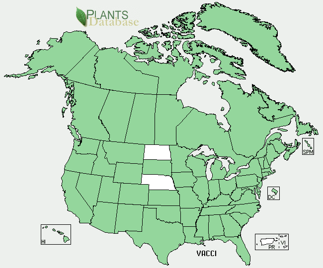
A map of locations where blueberries are found in North America. USDA, NRCS. 2009. The PLANTS Database (http://plants.usda.gov, 11 April 2009). National Plant Data Center, Baton Rouge, LA 70874-4490 USA.
Copyright status:
public domain because it was taken by the government and stated as public domain
Source:
File history
Click on a date/time to view the file as it appeared at that time.
| Date/Time | Thumbnail | Dimensions | User | Comment | |
|---|---|---|---|---|---|
| current | 22:43, 11 April 2009 | | 650 × 540 (20 KB) | Sarah1 (talk | contribs) | A map of locations where blueberries are found in North America. On the USDA plants database. |
You cannot overwrite this file.
File usage
There are no pages that use this file.