Summary
Mimas in Mercator projection, annotated.
Original caption
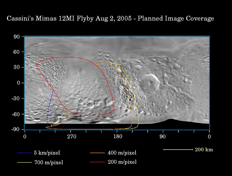
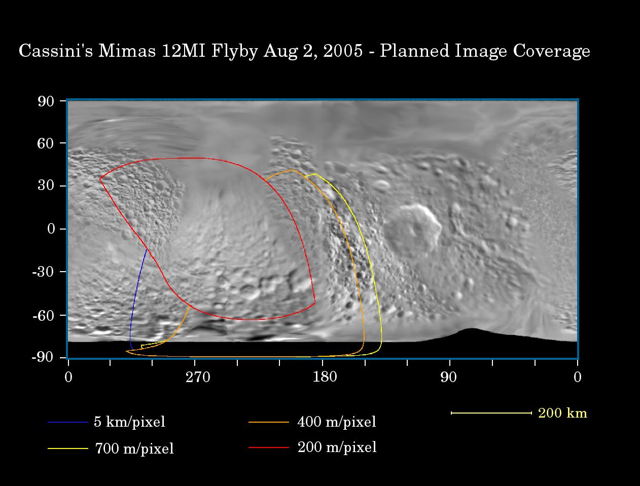
This map of the surface of Saturn's moon Mimas illustrates the regions that were imaged by Cassini during the spacecraft's flyby of the moon on Aug. 2, 2005. At closest approach, the spacecraft passed within approximately 62,900 kilometers (39,300 miles) above the moon's surface. Mimas is 398 kilometers (247 miles) across.
The colored lines delineate the regions that were imaged at differing resolutions. The closest images were obtained near closest approach. Mimas has never been imaged this closely before.
The flyby provided the best views yet of the south pole of Mimas and some of its northern latitudes, as well as distant views of the giant crater Hershel, near the terminator (the boundary between day and night).
The highest resolution images show the trailing hemisphere of Mimas, opposite Herschel. Several fracture systems have been seen in the region in NASA Voyager images, like Pelion Chasma and Tintagil Chasma. Images obtained from this Cassini encounter may help test whether these canyons, and others on Mimas' surface, are related to the formation of Herschel. Craters seen on this pass are named after prominent characters in the King Arthur legend: Arthur, Merlin, Uther, Modred and Morgan.
The Cassini-Huygens mission is a cooperative project of NASA, the European Space Agency and the Italian Space Agency. The Jet Propulsion Laboratory, a division of the California Institute of Technology in Pasadena, manages the mission for NASA's Science Mission Directorate, Washington, D.C. The Cassini orbiter and its two onboard cameras were designed, developed and assembled at JPL. The imaging team is based at the Space Science Institute, Boulder, Colo.
For more information about the Cassini-Huygens mission visit <http://saturn.jpl.nasa.gov>. For additional images visit the Cassini imaging team homepage <http://ciclops.org>.
Copyright status
This image is credited to NASA and the Jet Propulsion Laboratory. Per JPL/NASA policy and applicable United States federal law, such images are in the public domain, or, if they are owned by individuals or institutions other than NASA or JPL, may be used for any journalistic, educational, or personal purpose (but not a commercial purpose) without further authorization. NASA and JPL images, other than their respective institutional logos, or photographs of actual persons, are not subject to copyright and may be used without additional permission, unless otherwise declared. For details, see the JPL Image Use Policy Declaration.
Source
NASA/JPL/Space Science Institute <http://photojournal.jpl.nasa.gov/jpeg/PIA06255.jpg>
