File:World ocean map.gif
From CreationWiki, the encyclopedia of creation science
Jump to navigationJump to search
No higher resolution available.
World_ocean_map.gif (500 × 500 pixels, file size: 68 KB, MIME type: image/gif, looped, 4 frames, 10 s)
|
This image was uploaded to the shared "Image Pool" and is usable on any CreationWiki site. |
File history
Click on a date/time to view the file as it appeared at that time.
| Date/Time | Thumbnail | Dimensions | User | Comment | |
|---|---|---|---|---|---|
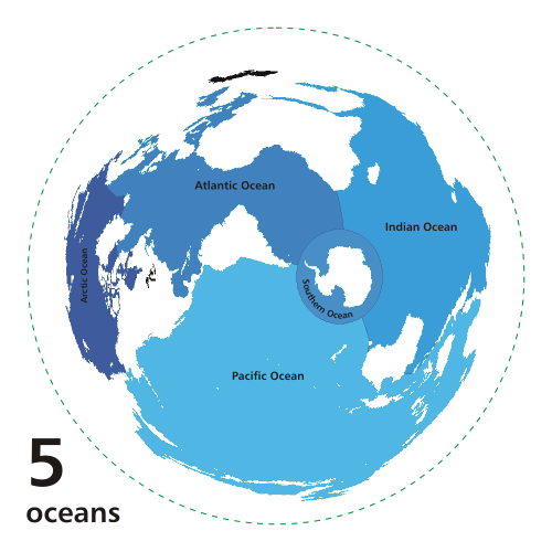
| current | 17:47, 19 November 2010 | | 500 × 500 (68 KB) | Ashcraft | Map of the worlds ocean from various perspective. Azimuthal distance projection map is based on world map from this online Java tool by Henry Bottomley and altered using CorelDraw/PhotoPaint, et al. Map is centered on 85° W, 45° S, rotated 90° CCW (No |
File usage
The following page uses this file: