No higher resolution available.

|
This image was uploaded to the shared "Image Pool" and is usable on any CreationWiki site.
Please go to the Pool to edit its description.
|
Summary
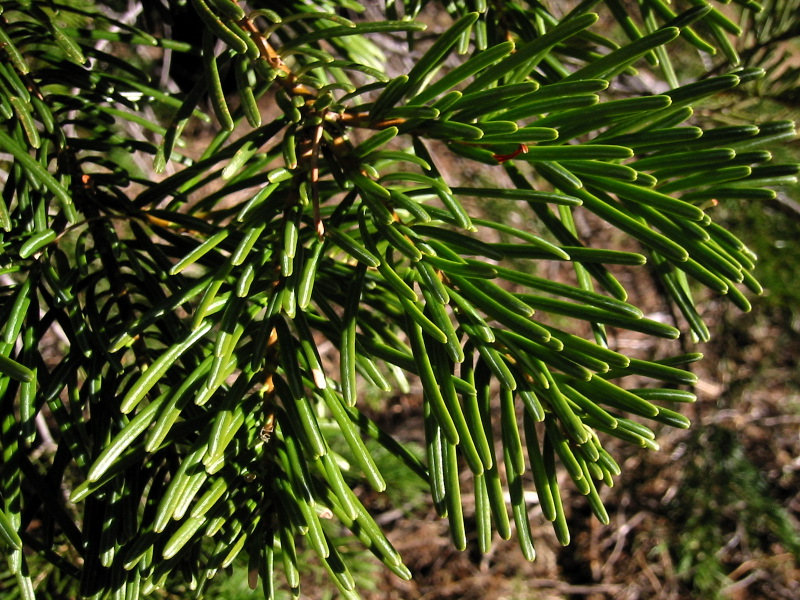
Abies concolor
Description: Low's White Fir, Abies concolor subsp. lowiana, foliage.
Viewpoint location: 50 m southwest of lookout road junction about 0.8 km north of Soda Mountain, Cascade-Siskiyou National Monument
Lat/Long: 42.0724°N, 122.4781°W (WGS84/NAD83) USGS Soda Mountain Quad [1]
Viewpoint elevation: 5600'
View direction: n/a
Date and time: 2005.10.22 16:21:4011 PDT
Camera: Canon PowerShot S110
Photographer: Walter Siegmund
©2005 Walter Siegmund
Copyright status
Permission is granted to copy, distribute and/or modify this document under the terms of the GNU Free Documentation License, Version 1.2 or any later version published by the Free Software Foundation; with no Invariant Sections, no Front-Cover Texts, and no Back-Cover Texts. A copy of the license is included in the section entitled "GNU Free Documentation License".
Source
http://en.wikipedia.org/wiki/Image:Abies_concolor_8076.jpg
File history
Click on a date/time to view the file as it appeared at that time.
| Date/Time | Thumbnail | Dimensions | User | Comment |
|---|
| current | 06:00, 10 May 2007 |  | 800 × 600 (267 KB) | Jcrain | Abies concolor Description: Low's White Fir, Abies concolor subsp. lowiana, foliage. Viewpoint location: 50 m southwest of lookout road junction about 0.8 km north of Soda Mountain, Cascade-Siskiyou National Monument Lat/Long: 42.0724°N, 122.4781°W ( |
File usage
The following page uses this file:
This file contains additional information, probably added from the digital camera or scanner used to create or digitize it.
If the file has been modified from its original state, some details may not fully reflect the modified file.