파일:Ararat anomaly.jpg
창조 위키
둘러보기로 이동검색으로 이동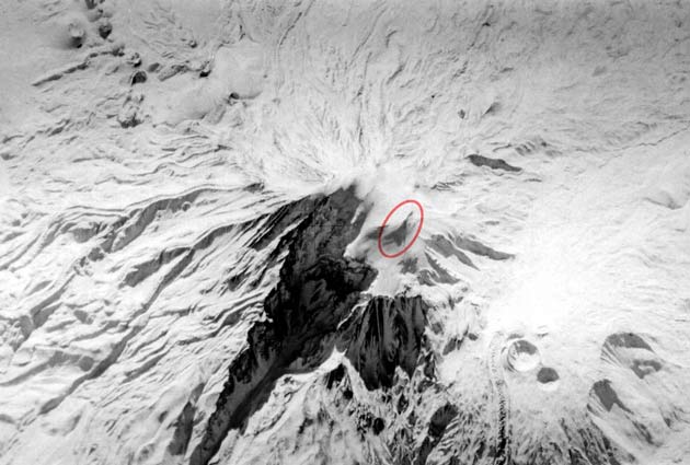
최대 해상도입니다.
Ararat_anomaly.jpg (630 × 425 픽셀, 파일 크기: 49 KB, MIME 종류: image/jpeg)
+Keyhole-9+satellite+image+of+a+panoramic+shot+of+Mt.+Ararat,+taken+on+Dec.+20,+1973.+The+%22anomaly%22+is+circled+in+red+by+researcher+Porcher+Taylor.+Several+years+ago,+the+CIA+declassified+over+55,000+satellite+images+of+various+places+around+the+world,+including+this+image.+Credit%3A+CIA/Porcher+Taylor+)
파일 역사
날짜/시간 링크를 클릭하면 해당 시간의 파일을 볼 수 있습니다.
| 날짜/시간 | 섬네일 | 크기 | 사용자 | 설명 | |
|---|---|---|---|---|---|
| 현재 | 2007년 12월 1일 (토) 18:05 | | 630 × 425 (49 KB) | Ashcraft | Declassified Central Intelligence Agency (CIA) Keyhole-9 satellite image of a panoramic shot of Mt. Ararat, taken on Dec. 20, 1973. The "anomaly" is circled in red by researcher Porcher Taylor. Several years ago, the CIA declassified over 55,000 satel |
이 파일을 사용하는 문서
다음 문서 1개가 이 파일을 사용하고 있습니다: